The crust surrounding Borexino
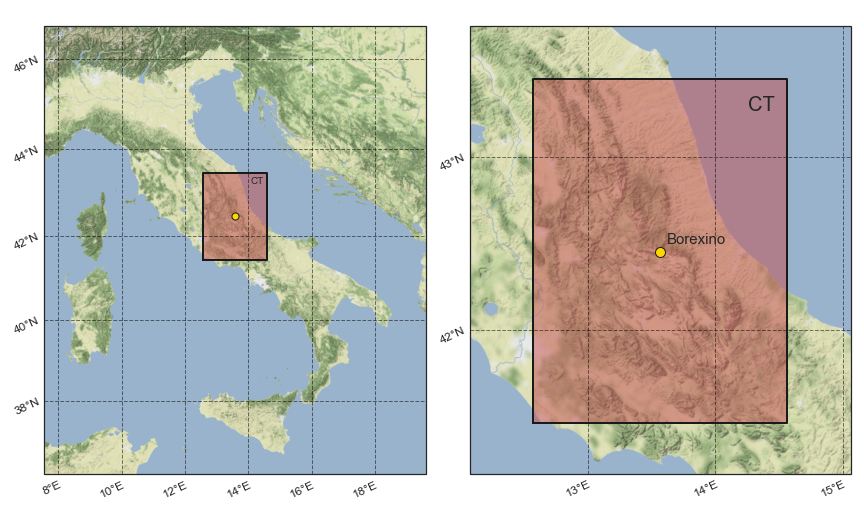
This web page provides the numerical 3D geophysical model of the crustal portion surrounding the Borexino detector, a liquid scintillator detector located at the Laboratori Nazionali del Gran Sasso (42.45° N, 13.57° E, L'Aquila, Abruzzo, Italy).
Detailed information about this model are published in:
The model can be downloaded at this link:
The Central Tile
The model describes the crustal structure of the Central Tile (CT), i.e. the 2° × 2° (∼ 200 km x 200 km) area centered in the Borexino detector with a typical resolution of 2.0 km × 2.0 km × 0.5 km. The geophysical model is based on a simplified tectonic model that includes the main crustal thrusts and near vertical reflection seismic profiles of the CROP project.
For each of the 1'115'867 voxels, the latitude, the longitude and the depth of the centroid are reported together with the volume, the density and the reservoir type of the voxel.
The geophysical reservoirs
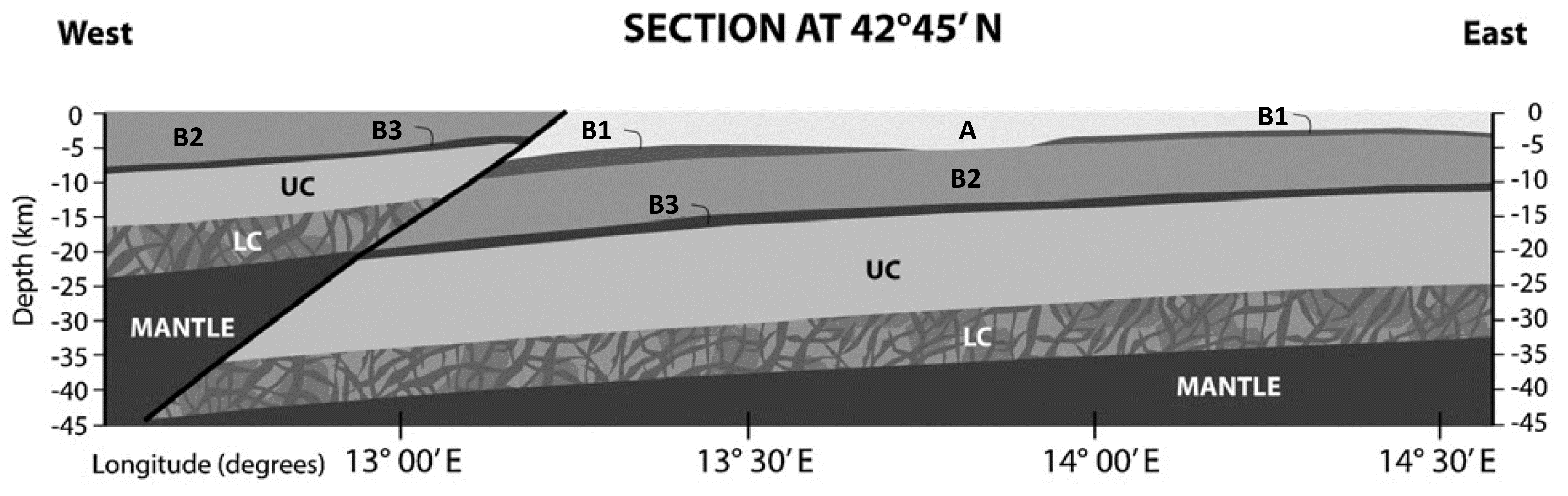
The CT exhibits a layered structure typical of the Central Apennines, with a sedimentary cover and a crystalline basement subdivided in an Upper Crust (UC) and Lower Crust (LC).
The sedimentary layer comprises four different reservoirs: a unit of Cenozoic terrigenous sediments (A) and three Permo-Mesozoic carbonatic successions (B1, B2, B3).
From the local seismic sections, there is no evidence of discontinuities attributable to the presence of the Middle Crust, which is therefore not included in the geophysical model.
| Label | Reservoir | Density [g/cm3] | Volume [%] | Mass [%] |
| A | Cenozoic terrigenous sediments | 2.1 | 6.8 | 5.3 |
| B1 | Meso-Cenozoic basinal carbonates | 2.3 | 0.7 | 0.6 |
| B2 | Mesozoic carbonates | 2.5 | 28.1 | 25.9 |
| B3 | Permian clastic units | 2.6 | 2.0 | 1.9 |
| UC | Upper crust | 2.8 | 38.0 | 39.3 |
| LC | Lower crust | 3.0 | 24.4 | 27.0 |